Lyø
Located southwest of Faaborg, Lyø is the westernmost island in Geopark The South Fyn Archipelago. From Faaborg, you can get to Lyø with the same ferry that also travels to Avernakø.
Lyø’s nature is varied and lush, and there are several nice beaches, fishing spots, and hiking routes. A tour of the island on bicycle is also highly recommended – and a good way to discover the island’s fascinating geology and a cultural history which goes thousands of years back in time. The cuspate foreland known as Revet in the northwestern corner of the island is an important breeding site for birds, and access is prohibited between 1 March and 15 July.
Lyø’s most impressive ancient monument is the dolmen chamber known as Klokkestenen (‘The Bell Stone’). The dolmen is believed to have been constructed between 3,500 and 3,100 years BC. When you strike the dolmen, a clear tone rings out, and when that happens, you will be granted one wish – or so the saying goes.
Because of epidemics and pillaging, Lyø became deserted in the 16th century. The island was repopulated soon after though, when 24 families were instructed to move there by their proprietor. The families then each built a farm, centred around the village pond. Because Lyø wasn’t affected by the Danish land reforms in the 18th century, many of the farms remain in place to this day, which makes the central village, Lyø By, quite special.

Photo:Mikkel Jézéquel
The Glacial Landscape of Lyø
Lyø does not have the oblong shape characterizing many of the islands in the South Fyn Archipelago. This is e.g., due to Lyø’s location in relation to the ice-movement patterns of the Weichselian ice streams.
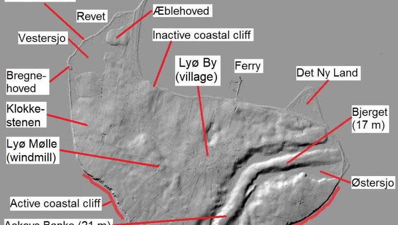
Lyø is almost split in two with regard to the features of its landscape. The southwestern part of the island appears as a single major hill. Lyø Mølle (the island’s mill) is located on the highest point, which reaches 24.6 m. The southeastern part, however, is dominated by two parallel valleys – a type of landscape, you won’t find elsewhere in the archipelago.
Throughout their course, the two valleys are separated by a narrow ridge with two peaks: Bjerget (16 m) and Askovs Banke (21 m). The valleys extend from the southern to the eastern coast with a pronounced change of direction about halfway across. It is unclear whether the valleys are two separate valleys, or just one single valley with an esker-like ridge in its bottom. During the Holocene period (from 11,700 years ago to present), the bottom of the valleys was gradually covered by freshwater deposits from lakes and fens. Østersjo, one of Lyø’s most important wetland areas, is located near the eastern end of the valleys.
Beneath Lyø’s valleys lies another valley, which is older. This subterranean valley is part of a ‘prehistoric’ landscape probably formed during an earlier glacial period. The valley is partly hidden from the naked eye and reaches a depth of 30 m below the surface of the sea. It is possible that the old valley was reused by later ice streams and meltwater rivers during the formation of the present, visible system of valleys.
Parts of Lyø's geological past are also revealed in the coastal cliffs to the south and southwest where sediments from three separate Weichselian ice advances are visible along with freshwater clay and marine clay with mollusc shells (‘Cyprina Clay’) from the last interglacial period, the Eemian (130-115,000 years ago).

Photo:Map: GeoFyn. Illustrated by: Søren Skibsted
The Dynamic Coastal Landscape
From the cliffs on Lyø’s southern and southwestern coasts, there is 11 km of open sea towards the island of Als. The coast is eroded by the sea, and currents transport the loose material around the island, depositing it in the calmer waters off Lyø’s northern coast and forming new land: marine foreland.
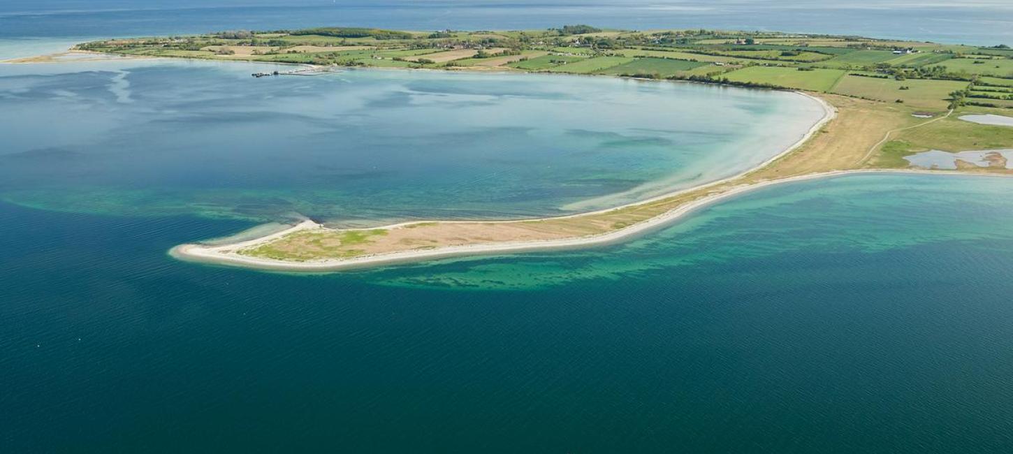
The area called Revet is Lyø’s largest marine foreland. It is a mosaic of salt meadows, beach lakes, sandy and stony beach ridges as well as the Lyø Trille spit system. The beach lake Vestersjo used to be an open lagoon, but now, the lake is tied off from the sea by beach ridges – most of the time at least. The three moraine mounds on Revet – known as Æblehoved, Bregnehoved, and Lammehoved – used to be small islets in the shallow water and served as ‘anchoring points’ when Revet was formed.
Located in the northeastern corner of Lyø, Det Ny Land (‘The New Land’) consists of a number of sandy recurved spits, one outside the other, which is slowly encircling what used to be an open lagoon. Det Ny Land was formed by northward littoral currents along the eastern shore within the past 80 years.
Longitude: 10.14954
Latitude: 55.04744