Geopark: Østrupgård
The Østrupgård buildings go back all the way to the 1300s.
Located amidst the hilly terrain of ‘The Alps of Fyn’ is Østrupgård manor. The rolling terrain north of the manor is dominated by sandy and gravelly meltwater deposits and today largely covered by forests, while the landscape to the south opens into fields and softer hills with more fertile soils. In this way, the manor utilises the same niche in the landscape that is often observed, namely a marginal location relative to the village community and a more direct access to resources such as forest and water.
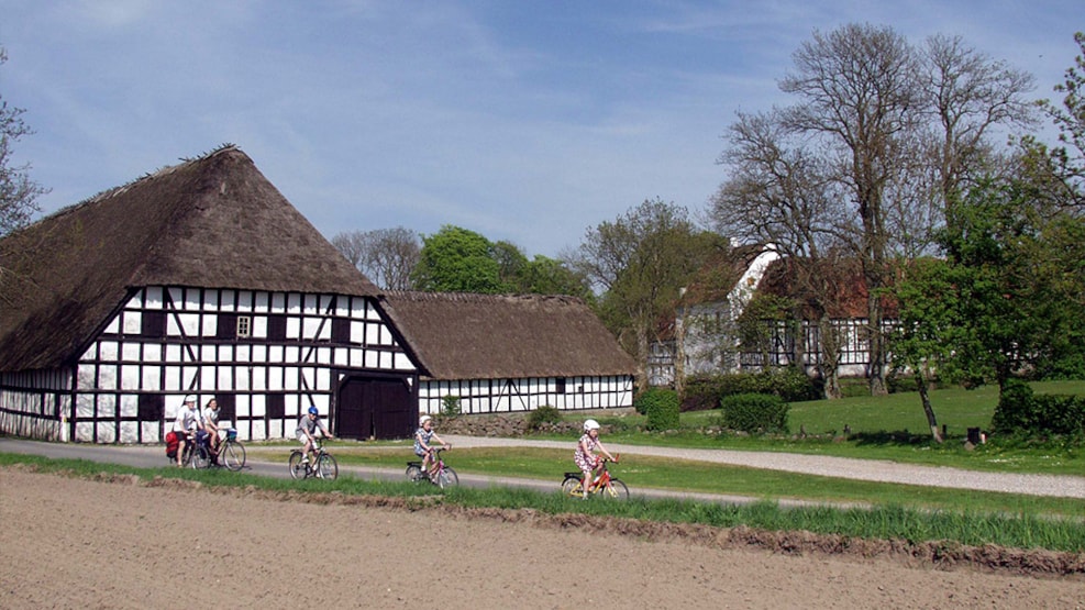
The Østrupgård buildings go back all the way to the 1300s. The core of Østrupgård is a square hillfort surrounded by wet trenches and one of the oldest stone houses still being used as housing. The three-winged main building is constructed with a foundation wall and half-timbering. The most visible features of the collection of buildings are the large farm buildings in half-timbering that surround an irregular square and the access to the hillfort. The farm buildings have their roots in the 1700s, and the long half-timbered façade toward the road is one of the longest ones in the country. In addition to being necessary, these farm buildings have also contributed to emphasising the riches possessed by the estate. The timber is heavy and in parts of the façade, double-posts (the short, vertical posts under the cross beams) have been introduced. The north wing blew down during the hurricane in 1999, but it has since been rebuilt.
Towards the south, you can see a typical smallholder settlement from the 1900s, but otherwise the landscape is dominated by fields and forests. As something unique, the main road from Svanninge is partly preserved to bear witness to the relationship between the tenant farmers and the estate owner. This relationship was critical to a large part of the population from the Late Middle Ages to the 1900s.