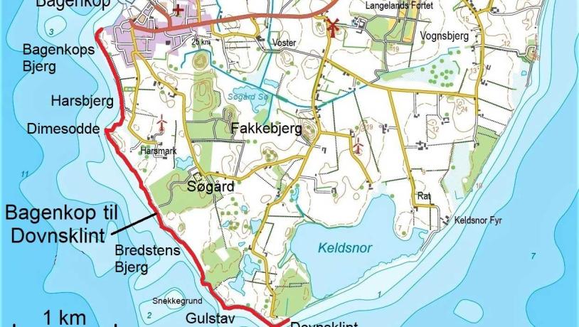
Bagenkop til Dovns klint (From Bagenkop to The cliff of Downs)
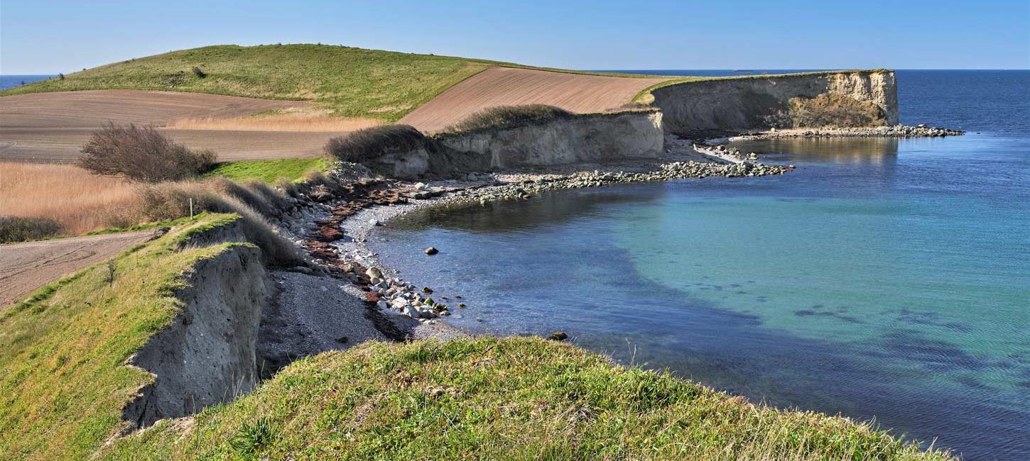
The four-kilometer stretch of coastline between Bagenkop and Dovns klint (Downs Cliff) offers a string of cliffs with beautiful views and pebble beaches.
The cliffs on the Bagenkop to Dovns Klint stretch tell the story of Langeland's unique Ice Age landscape. You can walk along the beach and along paths along the cliffs, and along the coastline are six dome-shaped hills, also known as hat hills. The hills are cut through by the sea and form high cliffs that allow you to study their internal structure and get a glimpse into Langeland's ice age landscape.
You can hike out to the cliffs from Bagenkop or reach them from several coastal parking lots.
Between the hat hills you can see even moraine surfaces with one or two thick layers of moraine clay, deposited between 19-17,000 years ago. In some depressions, bogs and wetlands were created after the Ice Age, such as Gulstav Mose, located about 500 meters from Dovnsklint.
Gulstav Mose (Gulstav Bog) is one of the Bird Protection Foundation's reserves and an important breeding and resting area. In the northwest corner of the bog there is a bird tower with a campfire site. The best time of year to visit Gulstav Mose is spring and fall, when you can see large flocks of birds of prey, pigeons and small birds.

Kystrækningen mellem Bagenkop og Dovnsklint på det sydligste Langeland. Geopark Det Sydfynske Øhav.Photo:Geopark Det Sydfynske Øhav
The ice age landscape along the coastline
Scientists have long debated how the hat hills were formed, and now modern research has shed some light on the subject.
Around 17,500 years ago, Langeland and the Great Belt region were covered by a tongue-shaped outlier, the 'Great Belt Glacier', which was part of the Bælthav Ice Stream. When the glacier stopped advancing and the outer parts of the ice turned into dead ice, large crack systems and depressions appeared along the edge of the melting ice on the surface of the ice. The cracks and depressions filled with meltwater and ice lakes formed.
Some of the material that melted out of the ice was carried with the meltwater into the ice lakes. Here the materials were sorted by the water and deposited as layers of clay, sand and gravel. Sometimes layers of unsorted moraine clay-like or very rocky material were also deposited in the ice lakes. This happened especially during periods of low water levels in the lakes, when landslides along the shores sent 'tongues' of slow-moving, thawed soil masses into the lakes.
Later, the still active parts of the 'Great Belt Glacier' pushed the dead ice and ice lakes, causing the built-up deposits to topple over and become vertical or oblique. When the ice melted away and the lakes disappeared, the deposits remained in the landscape as the hat hills we know today.
Varying local conditions have contributed to the fact that the contents of the hat hills are not uniform - along the coast between Bagenkop and Dovns klint, they contain more layers of moraine clay-like and unsorted, rocky material than many of those inland. Furthermore, the layers in the coastal hat hills also appear to be less disturbed by ice pressure than the layers in the inland hat hills.

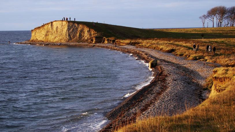
Landskab ved Dovnsklint. Geopark Det Sydfynske ØhavPhoto:Mikkel Jézéquel
The dynamic coastal landscape
Since the sea penetrated the area south of Funen in the period after the last ice age (Holocene) and created the South Funen Archipelago, the sea has been gnawing away at the glacial landscape. From South Langeland there are approximately 35 kilometers of open sea to Northern Germany and almost the entire coastline between Bagenkop and Dovns klint has developed as a steep coastline, where erosion has cut several hat hills in half and created high cliffs.
The ornament on Dimes odde is the last remnant of a hill that has otherwise been removed by the sea. The slightly garland-shaped coast is also a so-called equalization coast, where protruding points are eroded away and bays are filled in.
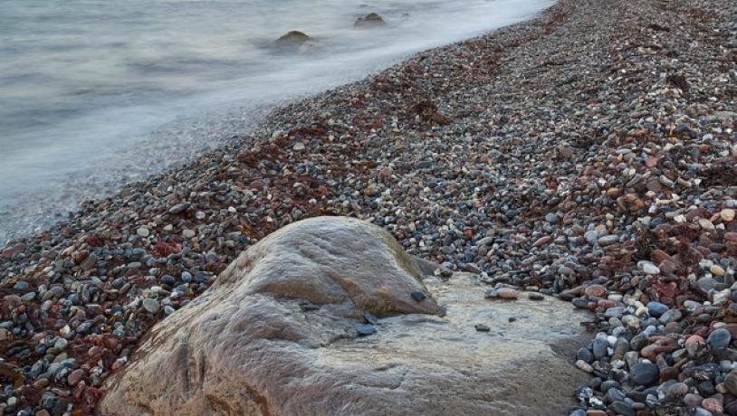
Today, the bay between Gulstav and Dovns klint is an area where material is deposited, including massive sea walls made of rounded pebbles, many of which are joint blocks from the Baltic region. In the bay, beach embankments have been found with stones up to 20 centimeters in size, deposited more than three meters above the current sea level. They may date back to a catastrophic storm surge in 1872.

Dovns klint fra syd øst. Geopark Det Sydfynske ØhavPhoto:Mikkel Jézéquel
Longitude: 10.693578
Latitude: 54.721922