Avernakø
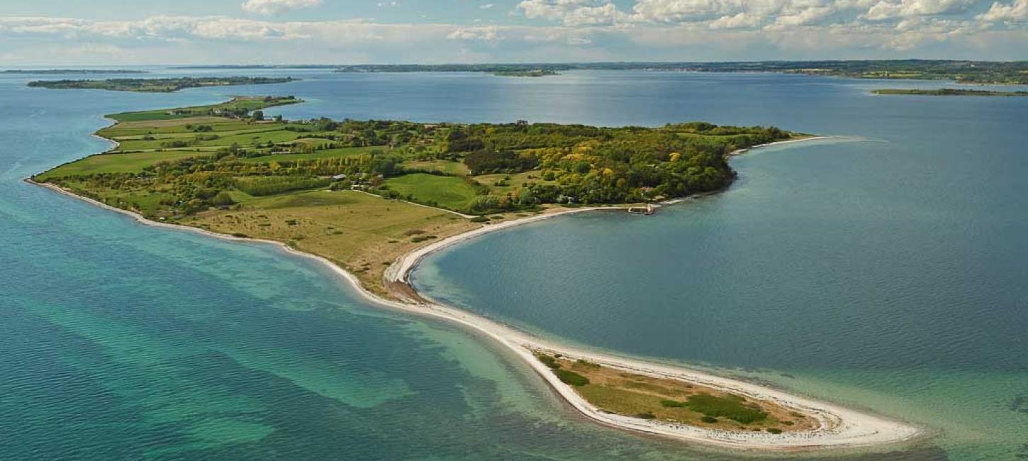
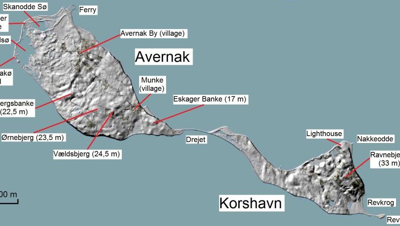
Located approximately 7 km southeast of Faaborg, the island of Avernakø actually consists of two separate islands – Avernak to the west and Korshavn to the east.
The two islands were eventually connected by a naturally formed isthmus made of marine sand and gravels. Such connections between two land masses are called tombolos. In 1937, a road was built across the tombolo (which is called ‘Drejet’), which in turn stabilized the connection between the islands. From Faaborg, you can take the ferry to Avernakø as well as to the island of Lyø, west of Avernakø.
Avernakø’s coastline totals 19 km and offers great sandy beaches, nice fishing spots, and a varied bird population. In some ponds on the island, you can see and hear the rare fire-bellied toad. There are signposted hiking and bicycle routes on the island as well as several nice accommodation options, including outdoor shelters. Please avoid Hovedsø and Revtrille from 1 March to 15 July as these areas are breeding sites for birds in that period.
Throughout history, there have been significant archaeological finds on Avernakø, the richest of which were made in 1685 on a field near the village of Munke: six sacrificial bowls of the purest gold engraved with solar symbols. Today, five of the six golden bowls are at the Danish National Museum. The sixth bowl were given to the French ambassador in 1812 as part of the ill-fated Danish alliance with Napoleon.
The maypole, which is known as a ‘may tree’ on Avernakø, is the island’s official flagpole and one of its main landmarks. The pole is a pagan fertility symbol, around which locals prayed to the gods for a successful harvest. Exactly when and how the maypole tradition started in Avernakø, is lost in the fogs of history; however, the villages of Avernak By and Munke both honour the tradition by decorating the maypole with beech branches and spring flowers on the Saturday before Pentecost.

Photo:Map: GeoFyn. Illustrated: Søren Skibsted
The Glacial Landscape of Avernakø
Just like Bjørnø and Ærø, the other oblong islands in the archipelago, Avernakø is orientated southeast-northwest, thus reflecting the flow direction of the last ice advances of the Weichselian glaciation.
The topmost soil layers on Avernakø primarily consist of moraine clay, and most of the landscape was formed by stagnant and melting dead-ice. Several of the highest hills, however, consists of sediments deposited by meltwater in hollows between the melting ice masses. When the ice had melted away, the sediment-filled hollows remained as hills. The result of this process is a hilly landscape with a lot of hollows. Today, many of the hollows have become ponds or small fens.
Avernakø is among the relatively few islands in the archipelago having cliffs on their northern and eastern coasts. Visible in the cliffs are various types of moraine clay and meltwater sediments deposited by at least three separate ice advances during the Weichselian glaciation. On the eastern coast of Korshavn, several-metres-thick layers of stone-free meltwater clay are visible, while other cliffs show layers of marine clay with mollusc shells (known as ‘Cyprina Clay’) dating from the last interglacial period, the Eemian (130-115,000 years ago). Like so many other locations in the archipelago, the cliffs indicate, that the various geological layers have been pushed together, folded, or thrusted on top of each other by the different ice advances.
The Dynamic Coastal Landscape
Avernakø’s southern coast is a simplificated coast, on which protruding areas have been eroded and bays have been filled. When the sea is eroding the cliffs, long-shore currents transport clay, sand, and gravel to the eastern and western tips of the island. In the calmer waters there, the material is deposited, thus creating new land: marine foreland.
Avernakø’s largest marine foreland is found to the northwest, conprising salt meadows, beach ridges, beach lakes, and recurved spits. This is Avernakø’s largest wetland area, with the beach lakes, Hovedsø, Skanodde Sø and the reclaimed Kongesø and Holmesø. Originally, the lakes were open bays, but throughout the years, they have been cut off from the sea by a system of beach ridges and recurved spits. At unusually high tides and during storm surges, parts of the area become flooded.
The southeastern corner of Korshavn also consists of marine foreland. At Revtrille, the island’s easternmost tip, another tombolo has formed. A small, protected bay, Revkrog, is located just north of Revtrille. Here, you will find one of Avernakø’s best sandy beaches. The island’s other beaches are narrower and stonier. At the northeastern corner of Korshavn, the straight spit, Nakkeodde, consists of marine gravels and shingle.
Longitude: 10.290359
Latitude: 55.019077